|
 Service Park, U.S. Army Corps of Engineers Land, AL:
February 10-11, 2017
Pink Loop, Orange Loop, Yellow Trail
Distance: 2 miles
[View Photo Gallery]
The second stop on mine and the dog wonder's little road trip/camping outing was meant to be nothing more than a place to hang our hats while we ventured over to Bladon Springs State Park, and a visit to nearby Choctaw National Wildlife Refuge. I'd reserved the campsite in advance after seeing a photo of the river view and decided it didn't get much better than that. Located on the 97 mile long Coffeeville Lake and situated just above the Coffeeville Lock and Dam, Service Park Campground ended up being a fantastic spot to hang one's hat. Also, they have trails! Though not listed anywhere on the U.S. Corps of Engineers website or social media pages, the lady at the sign in booth handed me a bit of a hand drawn trail map, which, hiked stem to stern, totaled about 4 miles or so. I couldn't very well pass up an opportunity to see these trails, and a place labeled Secession Bluff on a map, so we opted to forgo both Bladon Springs State Park and Choctaw National Wildlife Refuge until the morning and settled in at camp.
 One of two primitive sites in the whole campground, ours was the farthest, located at the point where a marshy slough and unnamed stream joined in with the river. A bit of a social trail spurred off down from camp, and I wish I'd brought a fishing pole of some kind, though the waters were quite turbulent. Even though this was a primitive site, it still came with water and an electric hookup, which was fantastic as I'd neglected to charge my camera battery properly. I also liked that with the added walk in from the parking area, we wouldn't have to worry about anyone walking or driving past us. Like Roland Cooper, the trees above us were laden was spanish moss. After setting up, we attempted to find the trailhead the showed within the campground but couldn't spot it. On the way in, I'd seen pink ribbons by a trash bin, and that lined up with another trailhead near the disposal station, so we parked on the side of the road there instead. The short walk uphill through the pine forest revealed no wildflowers here either, but I did find a sign notating this spot as another location of the Alabama Black Belt Nature & Heritage Trail. The trail was remarkably well groomed, but not over loved, and the junction sported some pretty new benches, as well as signage about kingsnakes. Is there a large population of them here? Were people killing them for some reason? The sign seemed oddly specific.
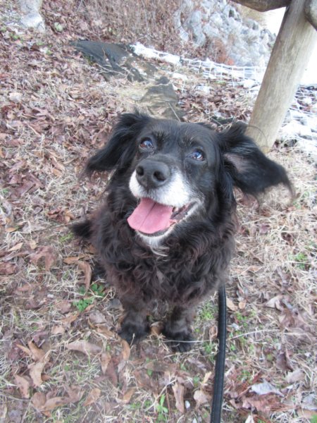 We set out down the Pink Loop, which didn't so much look like a loop as it did an out and back with a bit of a roundabout at the end. Lulu was already about halfway through what seems to be her limit on an outing, so this seemed to be an easier route for her to start on. Off to the side near the junction an old picnic table sat in disrepair, the wooden bench boards long rotted and shrouded in young trees. To our left was part of Secession Bluff, a tall hill it seemed for the area, but not quite what I was expecting, as there was no true bluff or outcropping of rocks, at least where we were. Below to our right, the trail paralleled an old roadbed with an old pond cut off and stagnant. The part sandy, part black rich dirt was something to marvel at, being unusually different from our usual stomping grounds. Ahead, the colorless winter landscape was broken by a large patch of bamboo, which seems to proliferate around springs no matter where we hike. The spring here gave us our first water crossing, though it was barely a step to get over. A second, dry crossing soon following before the trail turned downhill into a bit of a floodplain. The bamboo here turned the forest floor into a bit of a green sea it was so thick, mixing with a few small palms along the way. The old roadbed we'd been following seemed to terminate around here as well, a rusty old drain sort of sitting stagnant with water at the end. The trail became a bit of a natural water way, or perhaps was the spring itself, which Lulu enjoyed drinking from. Back uphill gently, I could see the campers in the distance, and the bamboo suddenly went away to reveal a very open forest floor with some tall hardwoods owning the area. A bit of a backwash from the marshy area behind our campsite seemed to begin here, but I suspect it was another spring too, though unfortunately littered with a water heater and wooden poles that looked like they were originally part of a dock that had ventured downstream during heavy floods along the river. We wandered out to the campground just to see where this missed trailhead really started, only to find there's no evidence of a trail here: just a utility box.
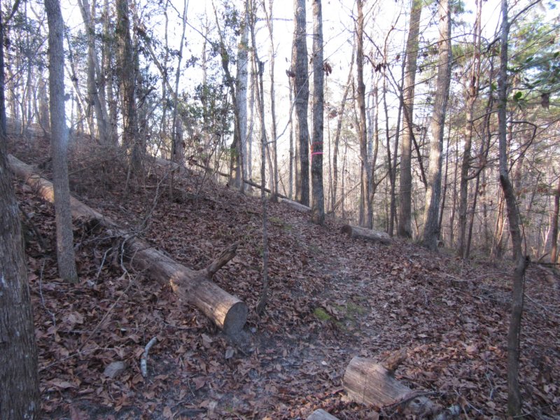
 Wherever the little loop was supposed to be, it's no longer there or evident, so we backtracked, stopping to photograph some wood sorrel and few mushrooms I'd missed. At the three way junction, we took the Orange Loop, though the first leg of it was highlighted with pink ribbons instead. Decisively uphill, the trail climbed nearly to the ridge of Secession Bluff, which wasn't quite tall enough to spot the river from, blocked by the little arm of land the campground was on [I could count several RV's from here]. The path followed the lay of the land, passing more interpretive trail signs, which seemed to be scattered across all the trails instead of one like what I normally come across in state parks. At a bit of a turn around the hill was a double ribbon tree usually marking a turn in the path, but this one had both orange and pink ribbons, which kind of makes me think they're planning on linking the far end of the pink trail up with the orange at some point. Also through here were the double marked private property boundaries, and what appeared to be a clear cut area on the other side [I'd later learn this was a greenfield, and a popular hunting area]. As we ventured downhill on the backside of the hill, a brief turn up of spanish moss was found, something most noticeably missing the entirety of the hike. I kept a watchful eye on the drainage to our right, which seemed deep enough to at least sport a small falls, given the one we found earlier in the day at Roland Cooper State Park. We crossed the dry drainage instead to find nothing more than just bamboo and damp ground before turning sharply uphill again. The effects of last year's drought seemed to hit the ridge area the most, with a large number of young pines completely dead through this stretch. Finally cresting the ridge of Secession Bluff, the trail zigzagged past wild ginger before peaking at another well placed bench. Wherever the little loop was supposed to be, it's no longer there or evident, so we backtracked, stopping to photograph some wood sorrel and few mushrooms I'd missed. At the three way junction, we took the Orange Loop, though the first leg of it was highlighted with pink ribbons instead. Decisively uphill, the trail climbed nearly to the ridge of Secession Bluff, which wasn't quite tall enough to spot the river from, blocked by the little arm of land the campground was on [I could count several RV's from here]. The path followed the lay of the land, passing more interpretive trail signs, which seemed to be scattered across all the trails instead of one like what I normally come across in state parks. At a bit of a turn around the hill was a double ribbon tree usually marking a turn in the path, but this one had both orange and pink ribbons, which kind of makes me think they're planning on linking the far end of the pink trail up with the orange at some point. Also through here were the double marked private property boundaries, and what appeared to be a clear cut area on the other side [I'd later learn this was a greenfield, and a popular hunting area]. As we ventured downhill on the backside of the hill, a brief turn up of spanish moss was found, something most noticeably missing the entirety of the hike. I kept a watchful eye on the drainage to our right, which seemed deep enough to at least sport a small falls, given the one we found earlier in the day at Roland Cooper State Park. We crossed the dry drainage instead to find nothing more than just bamboo and damp ground before turning sharply uphill again. The effects of last year's drought seemed to hit the ridge area the most, with a large number of young pines completely dead through this stretch. Finally cresting the ridge of Secession Bluff, the trail zigzagged past wild ginger before peaking at another well placed bench.
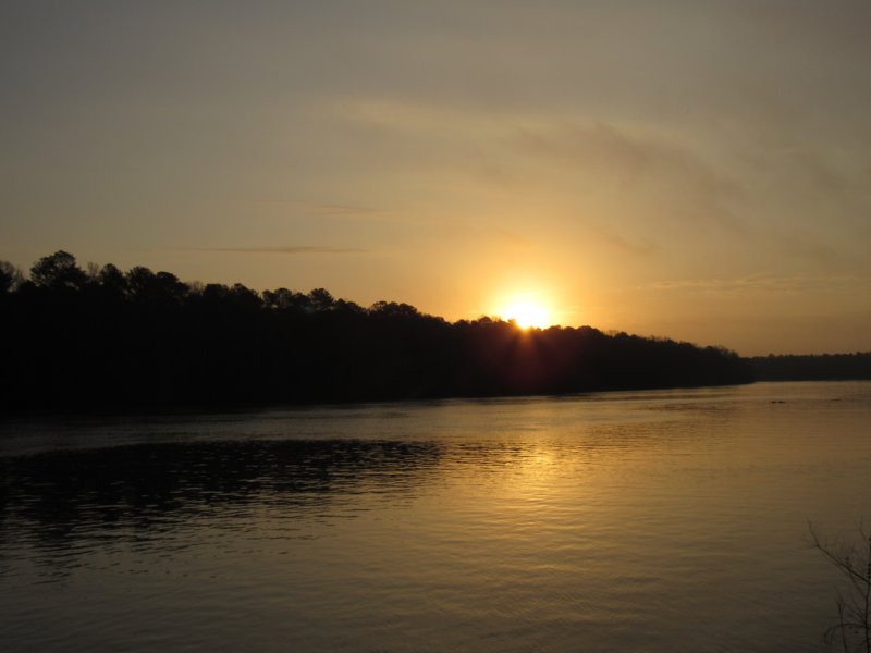
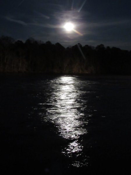
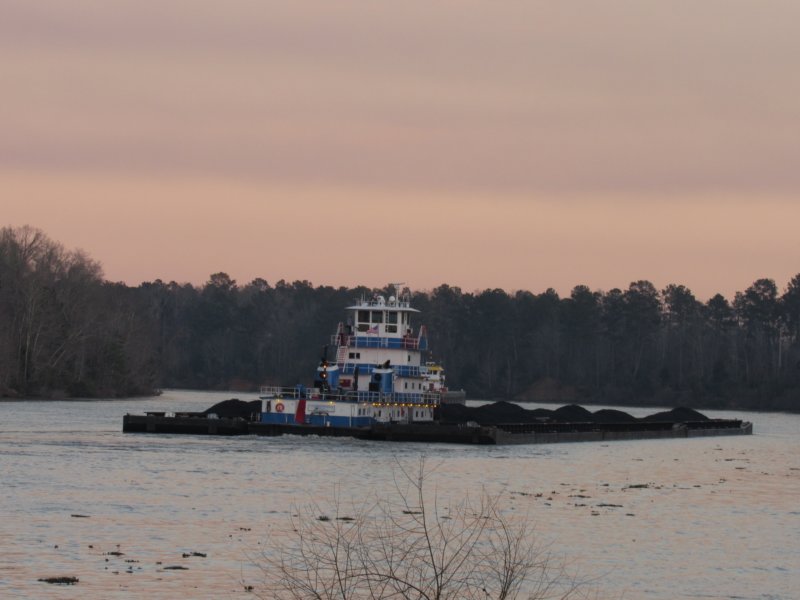 The section ahead doesn't seem to get quite the foot traffic, as several large dead pines blocked the path a bit, though Lulu had little issue hopping over. The interpretive signs through here were almost entirely related to grasses and controlled burns, which despite the pine laden ridges which benefit from such burns, there were no real grasslands around. Moving downhill now past patridgeberries, we went through a series of gently rolling hills and a dry drain or two before a little two board bridge a more substantial spring. The next crossing was the most substantial water we'd seen yet, and with no threat of alligators here at least, I let lulu indulge in the crystal clear spring water until she got her fill. The trail then swung a hard left and met up with the blue trail again, us taking the fork leading back toward the car. We'd end up not doing the blue loop, but that leaves something to come back and see, and with as many stops as we'd have the next day, a long evening at camp by the fire seemed the smarter option. Passing several more dry streams, including the one that was flowing just uphill, we climbed out of the valley again over more deadfall. At the junction with the Yellow Trail, Lulu indulged my wanting to venture down to the kiosk I'd seen by the gatehouse coming in. A reasonably flat and scrubby young mixed forest, all of the interpretive signs through here related to wild turkeys oddly. The sign at the kiosk labeled Service Park as part of the West Alabama Birding Trail, which a large poster of those that call the place home. Of those listed, we only heard one, a woodpecker, but I had hoped to see a bald eagle here. Back on the blue trail the trail briefly became rocky, and sported the highest volume little springs yet we had to cross. Uphill, as we neared the junction, most dilapidated picnic tables came into view, their wooden benches either rotted or covered in lots of resurrection ferns and mosses. Back at camp, we spent the rest of the evening watching the barge traffic go by [mostly hauling coal], with boat names such as Amelia Parker, Thelma Parker, Mr. Roland, and Temple Huckabee. The narrow channel of the Tombigbee River compared to the Tennessee River felt like I had a front row seat watching them all meander past or hang out for hours at times. Flocks of blue herons, along with some cormorants and great white herons darted to and fro, not really paying much attention to it all. We took a notion to explore the little game trail out down from camp, which quickly ended in a marshy area full of tall grass, which we turned back from. As the full Snow Moon rose, we managed to see the partial lunar eclipse before the clouds moved in to obscure it all. One of the most interesting parts of the evening was the barges turning on their “high beams”, illuminating the entire far bank at times, and clear to the next bend. Morning brought more barges, though the only name I caught was the Greenwave. A small group of great white herons landed in the little slough next to camp, and a beaver came out to play, allowing an easy chance to photograph them. After breakfast and spending time enjoying the sunrise, we made a quick pack of camp. Another great day of adventure was just ahead.
|