|
 Choctaw National Wildlife Refuge, AL:
February 11, 2017
Nature Trail
Distance: 0.75 miles
[View Photo Gallery]
Just upstream on the Tombigbee River from Service Park is a bit of a hidden birder's paradise, the Choctaw National Wildlife Refuge. Approximately 4,200 acres in size, it serves mostly as a wood duck habitat, and most areas of it are low and inaccessible; much of the wetlands here were created by flooding from the construction of the Coffeeville Lock & Dam in the early 1960's. From what little can be found online I knew it at least had a trail, and it too was a spot on the Alabama Black Belt Nature & Heritage Trail. Finding the refuge wasn't as difficult as finding the trail, which added a little adventure to the visit.
 Possibly most important before one visits this place, and something I'd wish I'd been aware of before visiting, is the lack of any amenities. There were no restrooms, and , manned by a skeleton crew, no one around to help, if needed. As a result, this required us to backtrack to the road split and briefly venture to another U.S. Corps of Engineers site, Lenoir Landing Park, which did have a bathroom. We spent a few minutes looking around, as this was where I'd originally intended on us camping, more or less because I wanted to see Tallawampa Creek [I loved the name]. A steep boat launch and thick brush really prevented “seeing” the creek, and considering the isolation and condition of this unmanned mostly day use park, I'm glad we stayed where we did.
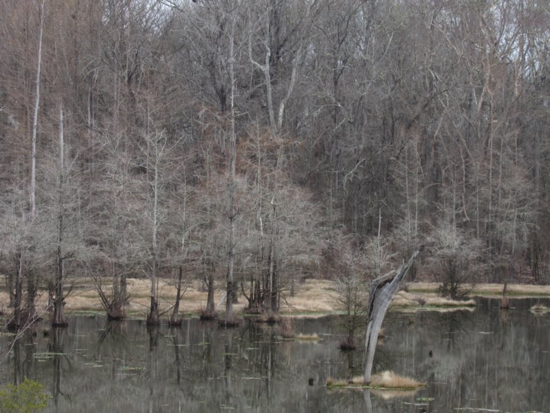
 Back at the refuge, we stopped at the information kiosk across from the work center/refuge office to pick up a brochure, which didn't speak of the trail, which was also not notated on the map above it. I knew the trail was approximately 0.75 miles long and led to a blind overlooking a moist soil unit. The blind was visible on imagery, though the distance seemed off. From the kiosk, we followed the short concrete sidewalk to a bench overlooking some backwaters off of the Tombigbee River, filled with cypress and deciduous trees just starting to bud out. I'd really hoped to see some alligators this trip, even if early in the year, and perhaps bald eagles, as the refuge has a nesting pair. As clouds moved back in, we drove past a sign mentioning a hiking trail “ahead”, and found the birding trail kiosk instead. It made sense for the trail to start from here, but after a bit of searching, I gave up and instead spent time reading the kiosk signs, which talked a lot about the Blackland Prairie, and this area being the southern fringe of a habitat now 1% of it's original size. Continuing down the road, we passed the boat launch, and a gated road, the dark orange dirt striking a nice contrast to the green grass reemerging, and the wispy spanish moss all around. After coming to where the road began to parallel Okatuppa Creek, one of the dividing boundaries of the refuge's three units, we backtracked to the gated road we saw earlier.
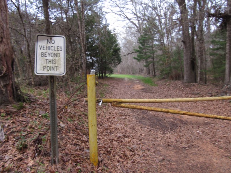
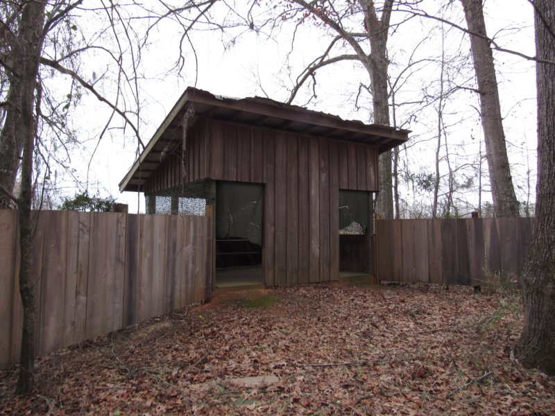
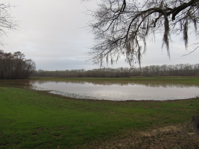 Though there were no signs here, this seemed the best spot for a potential trail, just an old gated road that appeared to lead out along the edge of a field, farmed to attract wildlife. We made pretty quick work of the flat ground, but unfortunately spooked a flock of ducks using a large pond ahead. I spotted the wildlife blind pretty quickly then, hidden in the bend, and realized we weren't in fact on a trail. A brief bushwhack brought us onto a lightly used path and the backside of the large blind. I was surprised at the lack of litter, but one would have to actually find this place to leave litter, I suppose. We spent a little while looking out over the pond and wet fields, sort of part of Judy's Slough, the backwaters of Okatuppa Creek, and the Tombigbee River. Determined to find the trail now, it seemed to split, with a faint trail leading off generally in the direction of the kiosk, and the more maintained route veering hard to the left. I opted for the heavily used path, which, after no longer seeing the information signs that were at the blind and tend to follow along on these interpretive trails, I realized it was nothing more than a service road. We passed a large pile of old rotting duck boxes, and spent the rest of the route winding back and forth through very gently rolling terrain before passing an indian marker tree right at the backside of the work center. I knew the birding kiosk was around the other side to the right, but knowing that this wasn't really the trail, we backtracked again.
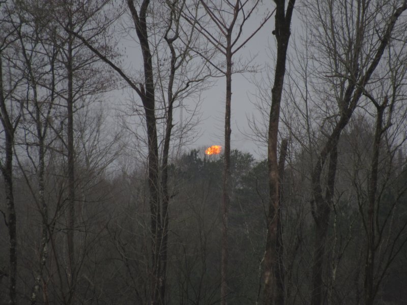 At the blind, we took the other route, which soon opened up into a recognizable path, leading up to a bit of higher ground above a dark cut off pool circled with cypress. Covered in what looked like duckweed, there was a visible path through it all that screamed alligator to me, so we steered clear of the edge, and unfortunately, a decent swath of spanish moss. As we topped the hill, I found plenty of wild hog sign, including a large rub out at the base of a decent sized pine tree. Descending again, I spotted a game trail tailing off to the left, which possibly led back to the kiosk, but we didn't follow. Shortly thereafter, though, the road itself came into view and the trail terminated, or I guess started, right on the road itself midway between the birding kiosk and where parked at the gated road. From the road, it'd be most unlikely to spot this at all, which is a shame considering how easy the path was to follow. The trip wasn't really complete until we stopped on our way out to photograph what appeared to be a natural gas well of some sort, though it's meter didn't seem to be registering anything. The land around here seems to be a hot bed for natural gas and oil mining? Some of the fiery burn off from tall pipes visible were through an extremely large clear cut area adjacent to the refuge. Before heading back to camp, we had one more stop on our list to see, another of the state parks closed a few years ago.
|