|
 Roland Cooper State Park, AL :
February 10, 2017
Chipmunk Trail, Lakeside Trail
Distance: 2 miles
[View Photo Gallery]
With a long weekend, Lulu and I finally got around to a road trip planned for several years ago in southwest Alabama. I'd never hiked in that part of the state at all, and had wanted to see four state parks there before they were shut down because of budget issues. The state handed over control of those parks to counties and other companies, and of the five total closed, four have since been reopened. Deciding to make a bit of a loop before meeting up at Robin at our Valentine's Day spot at Payne Lake Recreation Area, we managed to see three state parks, a bit of a hidden national wildlife refuge, and also explore and camp for the first time at a U.S. Corps of Engineers park. Our first stop on the trip was to Roland Cooper State Park, a small state park on the banks of the Dannelly Reservoir impoundment of the Alabama River. Though the effects of years of low budgets were pretty evident across the park, the private company running had made great improvements in less than 6 months after officially reopening. I'd spent a long time looking at this area, so rich and steeped in history, most notably Gee's Bend and the several ferries around [though only one is still in operation], that I'd hoped to have a shot at exploring around a little. A late start on the trip, and an odd ferry schedule that would have pushed me back an hour meant unfortunately that I had to forego seeing that part of the area, but it is something I will be back for.
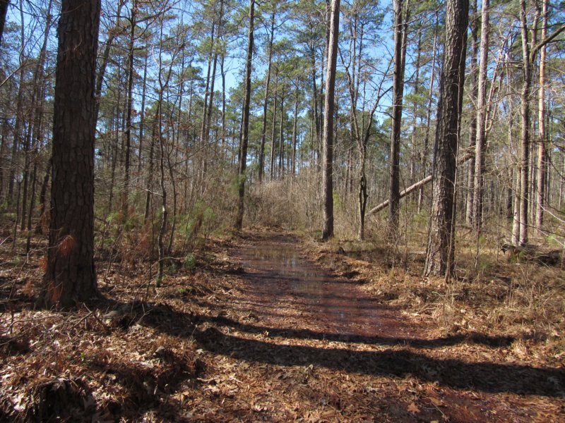 Getting to the park itself is a little bit of a chore, and requires some navigating down some rough paved roads to the point one wonders if there really is a park at the end of this asphalt tunnel or not. The front gate is on honor system for the moment, so I made a stop at the camp store for a trail map, which also proved fruitless. The kind lady working there happily pointed me in the right direction to find the trailheads, at least [and gave me a cool souvenir from the park! If you happen to find this and read this, thank you!]. She also gave me a map of the area that discussed the numerous U.S. Corp of Engineer parks along the area rivers, and shared a few trail stories. Almost literally right across the road was the sign for the Chipmunk Trail, a half mile trail in theory that was said to connect to other walking trails. Situated beneath a tall pine forest, the trail was effectively an old road bed and bushwhacked for maintenance. After more than three hours in the car, Lulu didn't seem to care what it was so long as she out and walking somewhere. With the warmer weather, though, I was hoping for a least a few early Spring wildflowers. Not terribly long after the car was out of view, a little side trail slipped off to the left, but we kept forward to a junction with another old road bed. Through the winter brush someone's home was visible, along with numerous no trespassing signs.
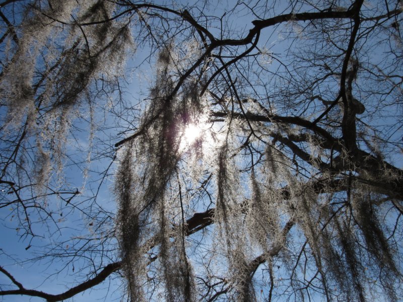
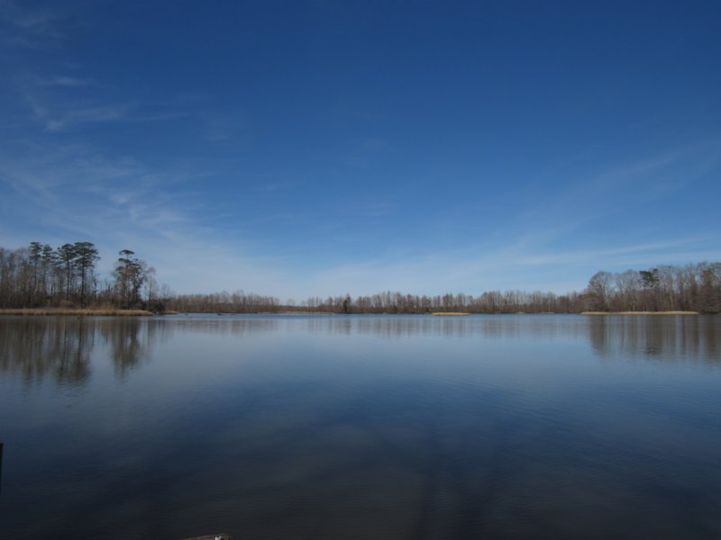
 Heading right, a low swampy area compelled me to cross into that no trespassing area ever so slightly for some great shots of what was probably a spring of some sort. That same water source seemed to be the cause of the sudden flooding of the trail, too. We walked along a bit of a berm between the low area and the so called trail until the berm itself became too soft to continue, and turned back. With no trail map to guide you, I'm really uncertain where this particular route ended up, though as we left the park later on, I believe it came back out to the road in an unmarked spot. After a brief stop to search an old battered pine for woodpeckers I'd heard [one of the few birds I actually hear in the forest], we ventured back the other route, which thankfully was completely dry. This section of the trail was more of the same, tall pines and thick underbrush that had yet to leaf out. I did spot one plant of some kind just beginning to emerge, but not enough to identify what it was. Taking the spur we'd seen earlier back at the car, we drove down to find the golf course closed, eventually making our way through the campground to the the birding trail kiosk. Every single stop on this trip also happened to be a stop on the Alabama Black Belt Nature & Heritage Trail. The kiosks are always a trove of information about the area; sometimes it's more information that I ever dig up on the location itself. Lots of spanish moss hung from the trees here, and it was good to be back in such a landscape. We wandered down to a picnic area that opened into a low floodplain of a space with a large oak of some kind standing solitary in the middle of it all. Knowing this area was stomping ground for some pretty large gators I spent as much time studying the thick troves of reeds and grasses [and paths through them] as I did photographing the wonderful backwaters of the river. In the distance a bit of a beach area from an adjacent but closed US Corp of Engineers park was visible. Lots more spanish moss lined the trees on the banks, and I spotted the trail sign for the Lakeside Trail, which at first glance seemed to at least hold more promise than the trail we'd just finished.
 The path started through a younger deciduous forest, with lots of small palms, but not much other plant life to speak of. The warm February really brought hope that Spring had started early, but not quite as early as I thought it would be. The winter scene though brought with it great views of the marsh area along the river, and perhaps provided a taste of things to come with mine and Robin's honeymoon in May. As the trail meandered on, it ventured uphill a tad, crossing a dry drainage while still providing views of the occasional cypress along the shore, which became more plentiful as the the hike led on. Remnants of an old fence were still wrapped around several of the trees, and some sumac was beginning to leaf out. A brief downhill jog crossed a more significant stream bed, though in good flow it would be the home of the only waterfall in the park, about a three foot drop. After a brief venture out to photograph the backwash area where the stream joined the river, the trail took it's only steep turn back toward the new cabins. It was through here that the spanish really thickened, and Lulu and I took a spur down to spot with a bench and single fishing pier, though this would have been an excellent put in for a kayak, if one were staying at the cabins. Small lilypads of some kind were already sprouting new leaves, though perhaps that's more normal being an hour and a half from the coast this time of year.
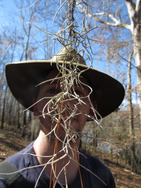
Back on the main trail, we meandered a little more into the woods, but far enough now from the cabins that the construction noise wasn't so much of an issue. Winding uphill, another little spur led down to a spot on a bit of an overlook where a bench would really be nice, A large tall pine on the far bank helped to break up some of the lack of green around, anchoring a spot on another backwash area that was part of the golf course not yet in ownership. The trail veered from a giant pile of tree limbs and debris to block that route and instead made it's way up to a far restroom on the back side of the campground and ended. On the way back to the car, I took the time to really enjoy the spanish moss, something I don't often have the pleasure of hiking beneath. An odd tree-like shrub with red berries [maybe southern spicebush] seemed to proliferate in one location. Crossing the dry stream with the waterfall again, I spotted deer tracks that I hadn't noticed as we went in. After a break for drinks, and a lot of hard thought about skipping the rest of the trip just to spend the rest of the day wandering back and forth through the spanish moss forest, we ventured on to our next stop, and camping spot for the night, Service Campground Park, on the Tombigbee River.
|