|
 Lookout Trail:
January 6, 2013
Sipsey Wilderness, AL
Distance: 5 miles
[View Photo Gallery]
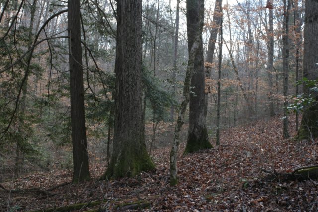
The risk of hiking with someone else is that things can change at the last minute. This is a good percentage of why I choose to hike solo, at least on my off trail adventures. Today’s outing, however, while something I hadn’t seen before, wasn’t off trail, nor was I allowed to hike solo. To ring in the first wilderness patrol [for me anyway] of the new year, we’d planned on doing the Mitchell Ridge Trail, perhaps an ambitious outing with short winter days that would have put the mileage count near 14. After some discussion, we opted for the Lookout Trail, about half that length. Outings in the Sipsey Wilderness have yet to disappoint, and this one would be no different.
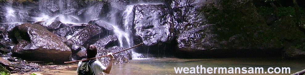
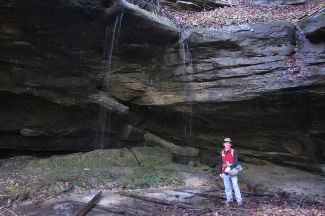
Our main worries with this trip and this location were ticks and chiggers. The old roadbed to the falls tends to get overgrown in the summer months, and is nothing but a haven for the itching annoyances. We stopped a few times before the upper falls to photograph some of the later summer wildflowers I’d hoped to see blooming. Among the many were downy lobelia, mountain mint, and rabbit tobacco. We scoured the grassy areas just before the descent into the hemlocks for evidence of Cranefly orchid, in bloom just a few weeks before, but found nothing. We also smelled a campfire somewhere, and soon discovered a group camping above the falls, which made trying to photograph the upper falls without their tents, bright clothing and blur inducing movements annoying. We waited around beneath the falls for a while, I got some tips and tricks on how to properly photograph waterfalls with the new dslr I’d been sent. I also took the time here to dismantle a “new” fire ring in the shelter behind the falls. Why anyone builds these things here is beyond me. Heating a water soaked sandstone outcropping above your head isn’t the best idea.
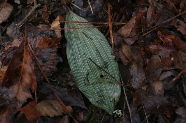
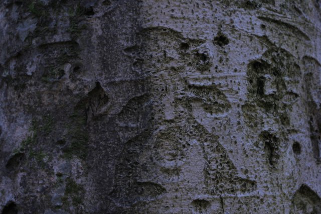
 After dropping one vehicle off at the far trailhead, we began our hike at the Borden Creek trailhead, taking time to gaze out from the old bridge. The water was deep today, as it usually is this time of year. Not long after starting we came to our first clean up area, a fairly new fire ring positioned to use a small boulder as a heat reflector. Inside the fire ring was the winter leaf of the puttyroot orchid, to my dismay. Disgusted, not only at the lack of respect, but also the fact that another fire ring lay less than 15 feet from this one’s location, I angrily threw the rocks out into the creek. My stance on Leave No Trace is well known, so I won’t get on that soapbox again. We did an exceptional job naturalizing the site, leveling the pile of ashes and covering the area with a lot of leaves in a way that blended with the flow of the surrounding forest. It’s the least we could do, seeing as there were no campers here to educate about how damaging this kind of behavior is to our wilderness area. We followed the trail or what we thought was the trail along the banks of Borden Creek for a while, until I came upon the sign for the junction of 207 and 203 here. This spot is one of two confusing locations in Bankhead, with the trail officially crossing in a spot that’s not really feasible to cross in. The trail follows the banks a little more before turning and climbing a little to the head of an intermittent drainage, with some short rock faces that features two wet weather waterfalls that were difficult to get to because of fallen trees. I did find an older tree carving in this area, but moss has reclaimed much of it on the tree, making it hard to decipher. Rounding the bend, the trail stayed high and well above Borden Creek, which was hard to see through the thick of trees. I wandered off trail some to check out what looked like a lower bluff wall, stumbling across rattlesnake plaintain and cranefly orchid’s winter leaves in the process. There was a bit of a wall here, may 8-10ft high, separately the sloped area above from a bottomland forest type environment below. The route continued to climb in elevation, taking us very close to the ridgeline here, with some small rock outcroppings. I noticed and photographed some small ferns protruding from the rock crevasses.
?
After dropping one vehicle off at the far trailhead, we began our hike at the Borden Creek trailhead, taking time to gaze out from the old bridge. The water was deep today, as it usually is this time of year. Not long after starting we came to our first clean up area, a fairly new fire ring positioned to use a small boulder as a heat reflector. Inside the fire ring was the winter leaf of the puttyroot orchid, to my dismay. Disgusted, not only at the lack of respect, but also the fact that another fire ring lay less than 15 feet from this one’s location, I angrily threw the rocks out into the creek. My stance on Leave No Trace is well known, so I won’t get on that soapbox again. We did an exceptional job naturalizing the site, leveling the pile of ashes and covering the area with a lot of leaves in a way that blended with the flow of the surrounding forest. It’s the least we could do, seeing as there were no campers here to educate about how damaging this kind of behavior is to our wilderness area. We followed the trail or what we thought was the trail along the banks of Borden Creek for a while, until I came upon the sign for the junction of 207 and 203 here. This spot is one of two confusing locations in Bankhead, with the trail officially crossing in a spot that’s not really feasible to cross in. The trail follows the banks a little more before turning and climbing a little to the head of an intermittent drainage, with some short rock faces that features two wet weather waterfalls that were difficult to get to because of fallen trees. I did find an older tree carving in this area, but moss has reclaimed much of it on the tree, making it hard to decipher. Rounding the bend, the trail stayed high and well above Borden Creek, which was hard to see through the thick of trees. I wandered off trail some to check out what looked like a lower bluff wall, stumbling across rattlesnake plaintain and cranefly orchid’s winter leaves in the process. There was a bit of a wall here, may 8-10ft high, separately the sloped area above from a bottomland forest type environment below. The route continued to climb in elevation, taking us very close to the ridgeline here, with some small rock outcroppings. I noticed and photographed some small ferns protruding from the rock crevasses.
?
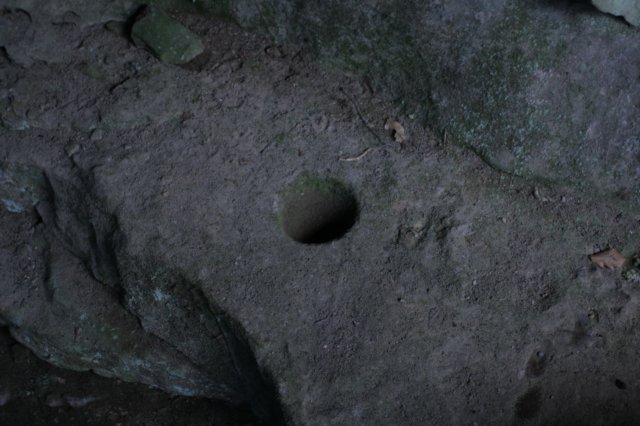
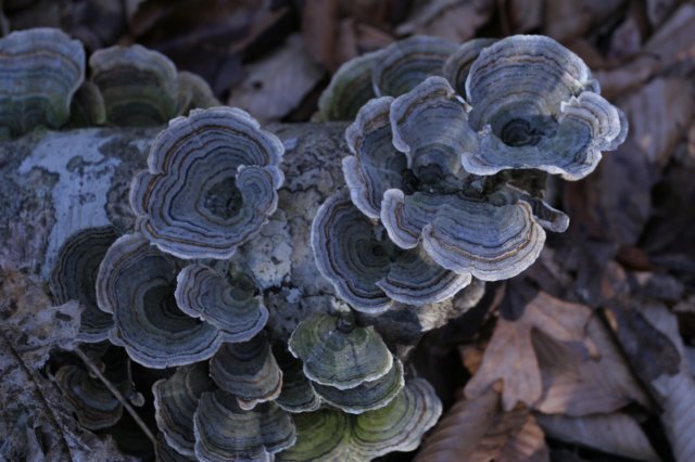
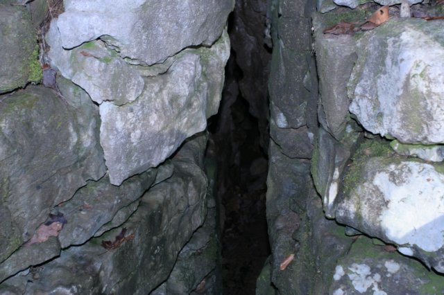
 After a rest, and with time slipping away from us, we marched, and it wasn’t long before we encountered our sixth and thankfully final pig of the day. This area really seems to be a hot spot for feral pig activity. We took gps coordinates of both locations for the forest service to use later on for scheduled hunts. The trail got sketchy for a little while with so much leaf litter and apparently very little use, but we managed to stay on track. We crossed another little tributary and found a beech tree nearby with an “x” on it. These traditionally marked boundaries or old hollow trees with bee hives. Around another bend or two we started seeing some interesting rock formations again, the kind of landscape one sees when there’s cave activity in the area. While we didn’t find a cave, after cresting one little ridge I did spot a small hole that went down to an unknown depth, but I wasn’t about to check it out. We crossed a wooden footbridge (the only one I’ve ever seen in the wilderness area, at that), and came upon an old beech with quite an array of old carvings on it. The stick figure with the hat caught my eye, and I’ve seen photos of it before, but was never aware of exactly where it was located.
 The land dropped off oddly and sharply on the left a bit, and curiosity getting the better of me, I ventured off trail here and down to find a nice sink and a decent sized pit cave, though I had neither the time nor the rope to explore it. A small ‘marker tree’, very obviously a recent make, pointed directly to the sink itself. It was really kind of silly; if one hadn’t noticed the sink by then, you probably weren’t going to notice this tiny tree pointing in it’s direction. With daylight starting to wane a bit we hurried on, but in the wrong direction. Following flagging placed along an old road, we ended up at Borden Creek, which I knew we weren’t supposed to ford. Backtracking quickly put us back on the correct route; exploring the sink caused us to skip the small section of trail where it abruptly turned and went downhill. I noticed some toothwort beginning to pop up from the leaf litter here, a sign that we’d have yet another early spring. We had to explore a little bit at the next unnamed stream crossing for an easy not-so-wet way across, as the water was deeper than I wanted to deal with where the rock cairns and log steps had been constructed in the banks. A sand bar downstream a little ways provided an easy route over, and we began the steady climb out of the drainage, through an area marked with old “Danger Shooting Zone” signs from days gone by. Soon we were back to the vehicle, no worse for wear, and parted ways back home.
|