|
 Little Cedar Mountain Small Wild Area, TN:
April 1, 2017
Little Cedar Mountain Trail, Pond Trail
Distance: 4 miles
[View Photo Gallery]
For part two of the day's adventure, we drove around the other side of Nickajack Lake to one of the many small wild areas the Tennessee Valley Authority maintains, and this one not seemingly well known despite it's proximity to the interstate. In my effort to dig up some history on this area and site, I ended up finding more controversy than history. An organization by the name of the Sacred Little Cedar Mountain Defense Coalition tried apparently in vain to keep TVA from selling much of the land on the north side of the reservoir to developers, and to keep trails from being developed on Little Cedar Mountain itself. I know the area was heavily used by Cherokee war chief Chief Dragging Canoe, that these were his homelands, but beyond that not much. Many Native American sites surrounding the area are now underwater. It seems that this land was chosen to be preserved as a small wild area due to it's uniqueness of not being capped by sandstone, and the erosion allowing unique and endangered plant life to
thrive there.
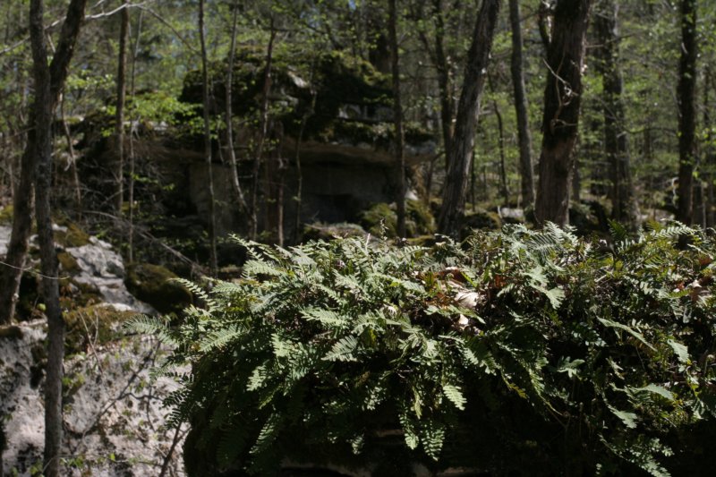 The trail begins as a short paved segment, a large area down the hollow to the right cleared years ago is regrowing a bit. Possibly the biggest negative about this trail was the traffic noise from busy Interstate Highway 24, which persisted even when one hiked to almost the southernmost point on the mountain. Crossing a small unnamed stream over a bridge that seems like it washes out at times, we followed a social trail left toward the highway, which just dead ended at the culvert under the highway. Heading right took us along the increasingly high banks of the stream and through a number of red cedars, of which the mountain is named for. As the trail turned left and slightly uphill, I took notice of what looked like a manmade rock retaining wall to control erosion from an dry stream feeding the main branch. Tall pines mixed with hardwoods dominated the landscape here, as did mounds of rocks and small boulders, sort of announcing the karst topography of the area. We passed remnants of barbed wire fencing, as well as clusters of rocks that seemed to have been placed there, either of old ruins, old campsites or perhaps some other significance. The rocky landscape reminded me a lot of what I've seen back home at Monte Sano and the Sipsey Wilderness. The wildflowers here weren't quite as hesitant to show up as they were at Nickajack Refuge, with blue violets and some trillium dotting the trail's path, as did cranes beard just past the split of the trail loop. We opted to head uphill to the left fork of the loop to avoid a heavy climb at the end of the hike. Just before, though, we chatted with a lady who warned it was a longer hike than she'd anticipated, and I wondered given the late start if we'd bitten off too much on this adventure. The switchbacks revealed a steady increase in rock formations, with more wildflowers such as indian pinks, red deadnettle and tons of resurrection ferns. I stopped to shine a light into some of the dark little holes in rocks searching for caves, but came up empty, though we did find a big enough shelter to provide relief from rain, had there been any threat. Lulu was in full explore mode, crossing a gnarly blowdown like a pro. As we made a small plateau, I stopped to photograph the seemingly undulating terrain atop, waves of rock forming a series of sinkholes that led nowhere. The next leg of the hill brought more boulders, though much smaller. That wouldn't last, as we found a pit cave that dropped an obvious 40ft before disappearing into a room of some kind. With no way to explore it, we pressed on, finding other smaller potential cave openings a few rock shelters, and more evidence of rocks being used as the foundation for something in the past.
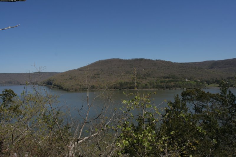
 Cresting the ridge, we headed downhill, descending quickly until we reached a sharp bend in the trail, with a long old stone retaining wall marking a former property boundary. Nickajack Lake was visible in glimpses between the trees, but the trail remained inland here, following the lay of the land. The steep hillside with a bunch of rocks on it, lay opposite the lake for as far down the trail as one could see. Coming across a social trail, we ventured out to the lake edge where Lulu lapped water and I sifted through freshwater mussel shells for any keepers. I photographed an unnamed island in the distance, and wished I'd had the kayak with me here to venture out and explore it. The trail led uphill, splitting at an old road bed that we followed a bit before the brush became too thick. A rare plant, John Beck's leafcup, was just sprouting through old leaf litter, and it was a bit surprising at the lack of wildflowers in this area given the number we'd just seen on the other side of the lake. I later chalked this up to being the dry side of the mountain. As the trail ascended again, we crossed one of the few blowdowns along the route. Otherwise, the entire trail was brushed out, clear and easy to follow. I stopped to photograph what I believe was a variety of smooth rockcress, though I've yet to properly identify it. With the exception of some short flat areas, the trail continued rise at a moderate rate, and we took advantage of those flat sections to explore some of the short rock walls that seemed to bound it on one side while the other offered views of the lake, if obscured. We passed american columbo, though not in bloom. I also spotted what looked like the backside of a shelter someone had attempted to construct or maybe use as a wind block. Being quite uphill and off trail I didn't push Lulu go to check it out with me. She needed more breaks than usual for water, as she's also not accustomed to hiking in hilly terrain, so when we finally crested the ridge I decided to make it a snack break, which she took advantage of by scratching a bed and laying down for a bit. The ridge on this end of the mountain was almost completely devoid of rock features, with a large open woodland feel, if many of the trees seemed younger. Along the path here, and just before the intersection with the Pond Trail, we spotted piles of rocks which I later figured out to be former rock cairns that people had toppled, but then just left instead of dispersing them. As we started the pond trail a large sinkhole came into view on the right, almost seemingly anchored by a large shagbark hickory. There was an easy enough way to get down into it, some 15ft deep at first glance. It seemed like it opened into a cave of some sort, but there was neither the time nor the interest on my end of potentially putting Lulu at risk with such an endeavor. As the trail progressed, almost completely flat, we found another smaller sinkhole and then an extremely narrow pit cave type opening that wasn't quite big enough for even me to get down into. As the dominant cedars on the wet side of the mountain came back into view, I noticed a number of them had been split, probably from recent storms. With the cedars also came more rock formations, and then the vernal pond. It seemed odd that it stayed full given the landscape, and lulu took advantage of more water and drank while I snapped photos. Though not terribly large, the kidney bean shaped watering hole was quite dark and appeared deep, though that's pure speculation. We found evidence of someone having camped here, a small fire ring completely contained atop a flat rock, and it appeared only small wood was burned. Though it wasn't naturalized, it was nice to see someone situating the fire in a place where it easily could be removed, though. We started to walk a little past the pond, but I didn't want to have to backtrack too much, and the pond trail acted as kind of a central connector/bypass for those not wanting to go all the way down to Gray's Bluff, which we wanted to see. Having done well on time, I decided we'd go on and do the full loop of the white trail.
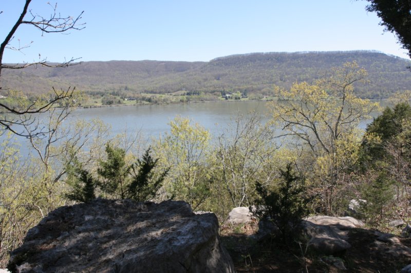
 Back on the main trail, the rock formations returned again, including one that seemed a series of larger rocks in a large ring around an old cedar tree. I do know that the Native Americans used this area extensively, but I'm unsure as to what role Little Cedar Mountain played. As we approached the bluff, I spotted someone lounging in a hammock off trail up on the ridge, and it was certainly a great day for it. The trail through here raised some questions, though. Some parts seemed recently created, and at other times, large piles of limbs were stacked in the trail itself, seemingly to try and discourage use. We found a way around them, though, and finally made it to Gray's Bluff. The spot offered a stunning view of the lake and of Raccoon Mountain in the distance to the north, Ladds Point on Sand Mountain to the east and south. In the middle of the reservoir, I spotted and managed to reasonably photograph an osprey nest on a navigational marker, the first time I can ever recall seeing one in the wild. A good rest on the bench conveniently located allowed time to peer over the bluff itself, which rose a good 40-50ft from the water. A large population of american columbo were here as well, though again none were in bloom. We also found prickly pear cactus, which seems to crop up a lot in limestone heavy areas I hike in, and oxalis, one of the few plants we'd seen in bloom so far. Just past the bench was the one heavy use campsite we found the entire trip, trash free, and a nice stack of dead wood for the next passerby. Heading downhill, the trail wound up next to the bluff edge again for a more natural view, and Lulu gave thought to chasing the lizards skirting across the large flat rocks. The trail led quickly downhill into a thick cedar grove, the path winding in and out of rock gardens before surprisingly turning back uphill a bit. This section seemed the youngest section of the forest, with saplings so thick you couldn't see through them, even devoid of foliage. Likewise, this section offered the least amount of protection from the sun, which felt hot despite being an mid spring day. As the path continued to rise, I stopped to photograph one of my favorite wildflowers, and one I don't see that often, hoary puccoon.
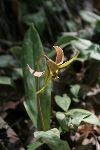
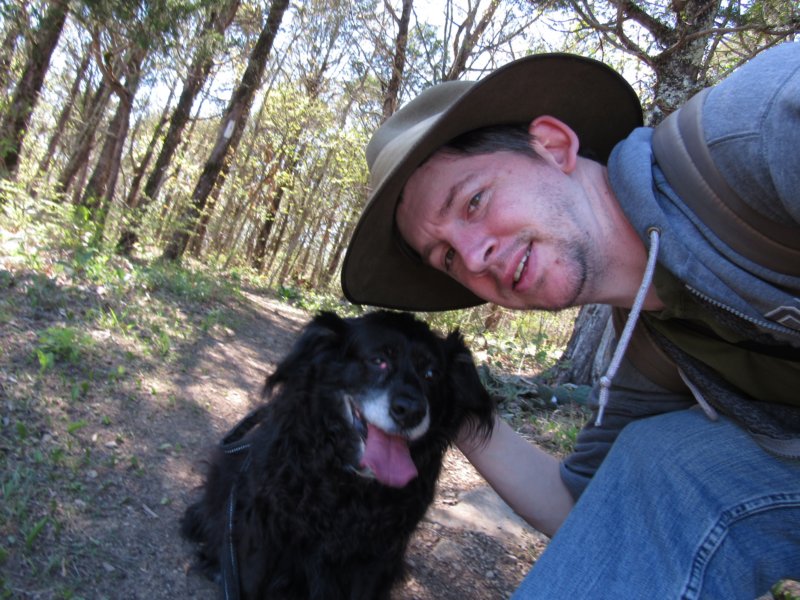 Meeting up with the pond trail, the path finally descended again, and as it did, the wildflowers began to appear. First, wood phlox, then many different types of ferns and mosses on wet seeps, along with cutleaf toothwort, cumberland spurge, and sedum. The trail at times offered glimpses into the unnamed stream we saw when we started, which separated Little Cedar Mountain and Anderson Ridge to the west. More wildflowers, rue anemone, and trout lilies made an appearance at the next wet crossing, The land began to undulate, and the next rocky outcropping brought a small sea's worth of trout lilies, again, past bloom, and some sweet betsy trillium along for the ride. Nearly open views of the backwaters of Nickajack Lake were visible here, and while the temptation was strong to venture off course to the water's edge in search of a cooler spot with trout lilies in bloom, we continued on. This side of the mountain was certainly easier on Lulu, though she searched still for water to drink, having surprisingly finished all of the large bottle I'd brought along for her. Soon, I spotted bamboo, which always signals a spring to me out in the woods, and we found more wildflowers yet, from twinleaf, to toothwort, and more trillium in bloom. Though no significant water here, a tall indian marker tree seemed to almost foreshadow what we'd find next: my long awaited trout lily in bloom, and not just one, but dozens. While the trout lilies blanketed the hillside downward, phacelia and sedum covered the rocks and lulu happily lapped all the water she wanted coming out of that spring. Here, I indulged myself downhill to seek out more lilies in bloom, and lulu found an appropriate Lulu sized swimming hole and cooled off in the water. An oasis on a mountain of dry and more dry, we lingered as much as time would allow and then wandered on, my only stopping to photograph brilliantly purple dwarf larkspur and jack-in-the-pulpit's, oddly covered with aphids. We passed what seemed a trail reroute, down the only constructed steps in the small wild area, crossed a bridge over a dry stream before discovering bellwort, more larkspur and puffball mushrooms. As we neared the completion of the loop part of the trail, I spotted another Native American marker tree way off to the side, which seemed to point downstream. Whatever the tree marked down lay underwater. Past the junction we noticed something I completely missed on the way in, an old treehouse or hunter's stand up quite high in the fork of a tree, though the lower boards had completely rotted away. Now late afternoon, and Lulu thoroughly tired, we made our way through the remaining bit of the trail back to the car and headed home.
|