|
 McKay Hollow/Stone Cuts:
March 2, 2013
Monte Sano State Park, AL
Distance: 7.25 miles
[View Photo Gallery]
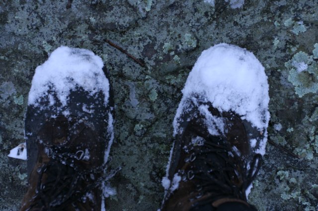
Hiking today was a bit of a gamble. Even thought we’d had snow showers off and on all night and the evening before, the valleys were too warm to support accumulation. In theory the higher elevations around would have seen something at least, but we certainly weren’t expecting a near winter wonderland of sorts when we arrived at Monte Sano State Park. That gamble paid off, as did others, exploring off trail down an unnamed stream into McKay Hollow, and later, a foray through the stone cuts and Golen Heights area in search of the elusive wild goat population.
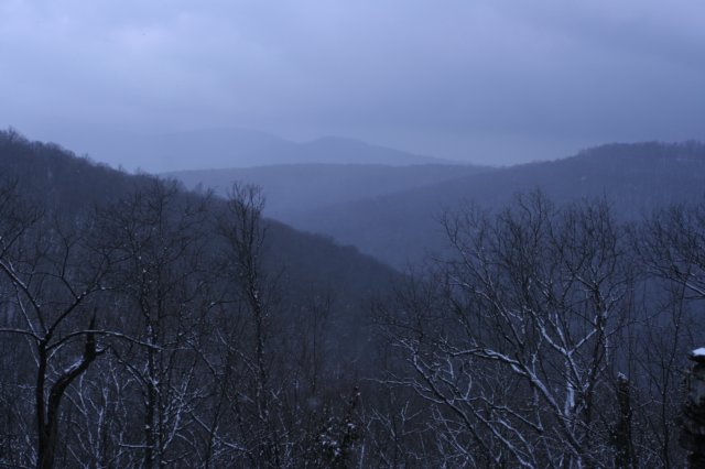
I got there early, and with about thirty minutes to spare, decided to go down to the large overlook with views eastward. Looking out across the valley and opposing mountain ridges echoed what I’d seen on the drive up: beautiful green valleys, turning to a brief area of spotty snow in the trees and elevated surfaces, to an inch to perhaps one and one half inches of accumulation on the ground itself. The temperature at the summit was near 31 degrees. I then decided to take a quick walk through of the Japanese Tea Garden, one of my favorite spots at Monte Sano, and a place I had not visited since early last year. The snow here was probably the deepest of any place I visited that day, and the tea house looked really nice. I took some photos from the inside looking out because of the interesting perspective it gives, and then crossed “the living bridge”, something I helped reconstruct last year when I did some work on the garden. Stopping just across the bridge, I laughed at the holly bush covered in snow, as it looked like a bunch of turkey tracks suspended in the air.
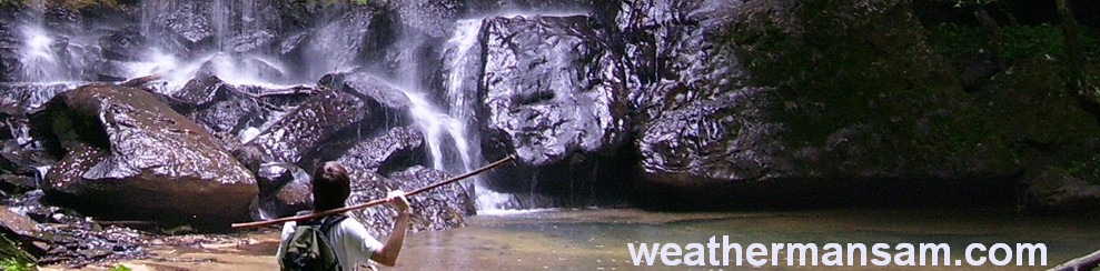
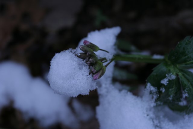
 When Zack arrived, we debated on which area to hike first, but another hiker in the parking lot spotted me with my camera and said if we were out to take photos, head to McKay Hollow, he’d just finished running it and it looked really nice. I also wanted to show Zack several of the larger falls at Monte Sano, so I’d planned on taking the “back door” in, i.e., off trail. We hiked the north plateau loop to the first of two footbridges over feeders that make up “lodge falls”. I always take the path down the left feeder, easier to navigate. I noticed early saxifrage in bloom in a little hidden spot beneath a tree root; once again it looks to be an off kilter year for wildflowers. Zack seemed pretty impressed with this waterfall, a hidden gem there and oddly not on any official trail at all. I still think most people aren’t aware of the array of waterfalls one can find here. Hearing more sound, I looked downstream and noticed a small side falls I’d never seen flowing before. The hillside here was coming alive with toothwort and other wildflowers, so we opted to walk the rocks for a bit before we could reach the smaller falls, which ended up being impossible to snap a good photo of. We debated some here just heading downstream until we hit McKay Hollow, but opted to head back to the trail and go visit another falls (we would later be very thankful we did not follow that particular branch downstream). Taking the south plateau loop off of the north plateau loop, we walked down to the next bridge and turned downhill on a now fairly well established social trail that leads to what I call the upper falls area, a roughly 10ft waterfall that’s nowhere as spectacular as the near 25ft falls just a little downstream. The rock formations here are very neat, eroding in an odd pattern that leaves part of the waterfall hidden in a way. I took note that someone has constructed a rock cairn on top of some of the other rocks as well here. Zack and I weighed our options here. We could return to the trail, take the long way around and do McKay Hollow start to finish, ending near O’Shaunessy Point, but we would sacrifice the chance to see the stone cuts and possibly the wild goat population. We could also bushwhack downhill into the heart of McKay Hollow, hike the easier half out and do the stone cuts. When asked if I’d ever explored this part of the state park, I answered no, and Zack’s response was, “Well, there’s a first time for everything”. Not far downhill the stream disappeared, as expected, given the composition of the rocks and cave system present at Monte Sano. The terrain became very rocky here, making travel slow and finding your footing hard with everything still covered in snow.
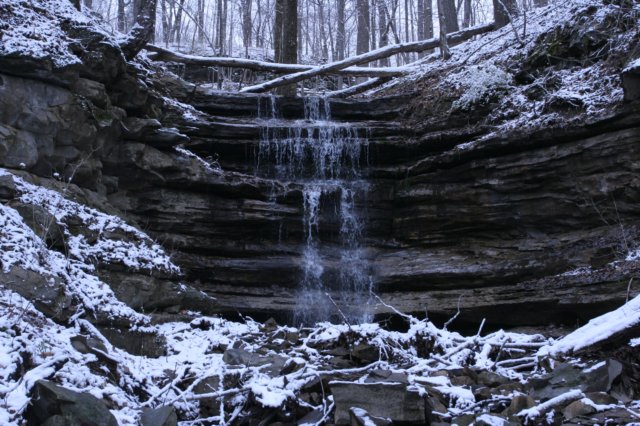
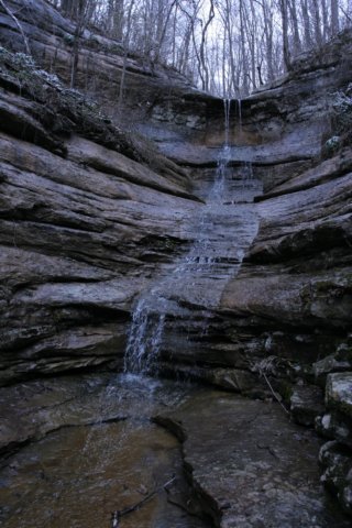
 As the elevation began to drop in sharper segments, I took a decent fall, slamming a knee into a rock, but thankfully not enough to hinder our progress. It began to snow pretty good once again, and the stiff winds blew bit hunks of snow out of the trees, which looked like massive snowflakes falling all through the forest. I’d wager that this area is the most remote part of the state park…there was no evidence that man had traveled through here at all. Soon, we came to a dry falls, and navigated our way along what appeared to be at best a game path, though we found no fresh tracks out here. Just below this was yet another drop off, of about 10 ft straight down. I decided to explore a route to the left, which Zack stayed high and went right. I went up and over a little outcropping and found a steady easy way down to the next level, and then heard the rush of water. We’d stumbled upon the largest waterfall I know to exist up there. Two large cascades separated briefly by a flat area, the upper falls was approximately 35ft tall, and the lower half near 20ft. The view down the canyon was nice, but we’d dropped below the magic elevation for snow and looked out upon a mostly barren winter landscape here. I, of course, was much more interested in the waterfall, and hugged a dogwood tree to lower myself down a bit to the flat area between the two cascades. This branch is the same one that “lodge falls” is on, and it is certainly a good thing we opted to not follow it down, as there would have been no route down from there. Zack finally found a way down from the route he’d taken, and after enjoying the falls for a bit, we went on, as the real trick was figuring out how to get down a very steep [but not shear], wet 20ft rock face. I eyeballed several methods, both of which required a jump at the end, and I deemed too risky. We reluctantly decided to climb uphill a brief bit to get around a fallen tree and then found a much more doable, easy game trail to follow down to the bottom of the rocks. I rock hopped up back up to the lower cascade for some good photos from this perspective. Of odd note, a much rusted 55 gallon drum was sitting in the plunge pool area of the lower falls. We also found a variety of wildflowers around here, narrow leafed toothwort, hepatica and harbinger-of-spring.
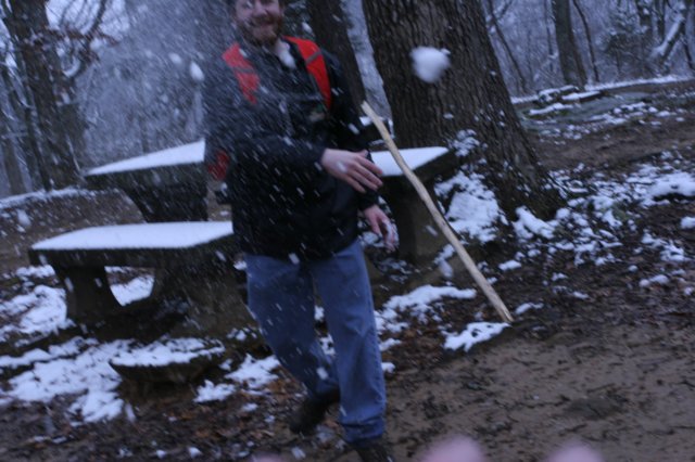
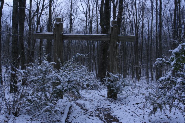
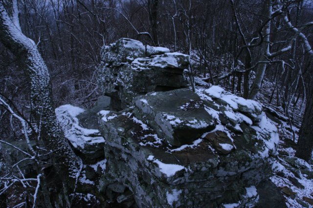 With time on our side, it was only proper that we engage at least briefly in a snowball fight. The picnic tables here on the ridge had about an inch and a half of snow, and someone scrawled a prom proposal on one of them. We made haste back to the vehicles and drove to the other trailhead to conserve time to explore the stone cuts area. It felt colder here, or perhaps the wind was blowing a little more it had been earlier. It didn’t seem to affect a dude on a bike we chatted with in the parking who didn’t expect to any snow, but he wasn’t letting it deter him. We set out downhill, and the temperature was certainly colder now, and it was the first time all day I felt chilled. The trails were fairly muddy, but made for easy hiking. I was quite surprised to not see a sign of any kind of wildflowers along this stretch, especially given what I’d seen earlier in the day. Reaching the next ridge, the trail technically turns left here and goes to the stone cuts. We instead turned right, heading uphill to explore the Golen Heights area in search of the mountain goat population that resides at Monte Sano. I’d seen photos of several of them, near O’Shaunessy point, but I’d also heard they liked the rocky areas here. It wasn’t long before we came upon another outcropping, and while I didn’t spot any tracks, there was an obvious game trail, and a chute like area that appeared to be used frequently. From here you could see back to the cabins on Monte Sano and to the overlook that points eastward, which was an interesting perspective. The rock flattened up a big, with drops becoming sharper on either side. I would have liked to explore along the base of the rocks, but the terrain was rough and we didn’t have that kind of time to play with. We came across a fire ring with a reflector wall built behind it, and a small wall that didn’t seem to have any purpose. We then came across another fire ring with odd rocks scattered here and there. I doubt they were used for seating, but they didn’t appear to be arranged in any pattern that I could discern. While neither of these fire rings were supposed to exist, there wasn’t a piece of litter to be found, and I left them intact. We then stumbled upon several large flat rocks stood up in almost entry way like fashion on side of the trail, with a small ghost painted on one of the rocks with some words that weren’t decipherable. Moving on, we came to several nice rock outcroppings with views east out over the farmlands in the valley. The trail all but vanished here, and the large haphazard pile of icy, wet bounders just ahead made us decide to turn back versus trying to navigate down them. Once back to the junction we headed over and through the stone cuts, one of my favorite areas on Monte Sano, and certainly one of the most unique spots there. The trails through the cuts are sheltered quite well, and thus, were dry and devoid mostly of snow. With a little time left, we decided to try and find the backdoor into the so called ‘super cuts’, aka Panther Knob area. We opted to stay on the sinks trail and cut back on the logan trail to make a short loop out of it. This area was really interesting; the snow wasn’t accumulating on the ground, but all over the shrubs and trees. It gave the area a very fantasy novel look, like everything was suddenly in bloom in large white clusters. I consider this area, or the feeling as we moved through it, one of the highlights of the day. The trail turned super muddy, and we did find the other route in to Panther Knob, thought when we reached the rocks, the trail sort of faded. The trail makes a hairpin turn, and after a little looking around, spotted it and climbed to the top. I didn’t find these rock formations near as interesting as features we saw earlier, but we completed the objective Zack was after, so it wasn’t wasted time by any means. Hiking downhill back toward the intersection with the logan and then the sinks trail, I noticed an interesting contrast in snow cover. Down slope to our left, the trees and ground were covered in snow, but to our left it was almost barren. I spotted cranefly orchid peeking through the snow and snapped a few photos, and then we set out back the way we came. The walk out was largely uneventful, until near the end. Stopping for break and a drink, I spotted movement down below where the trail made a switchback. A red fox meandered up to the trail, sniffed the trail, and moved on. With no vegetation to block our view, we managed to track and watch him for a while as he moved through the forest before finally leaving our view. Outside of a few squirrels, this was the only wildlife we saw that day, and the first fox I’ve ever encountered on a hike. So the gamble paid off in the end, with an outstanding hike discovering things along trails I’d never seen before, and getting to watch the fox was kind of icing on the cake, if the snow wasn’t.
|