|
 Bankhead National Forest, AL:
November 6, 2016
Owl Creek
Distance: 3 miles
[View Photo Gallery]
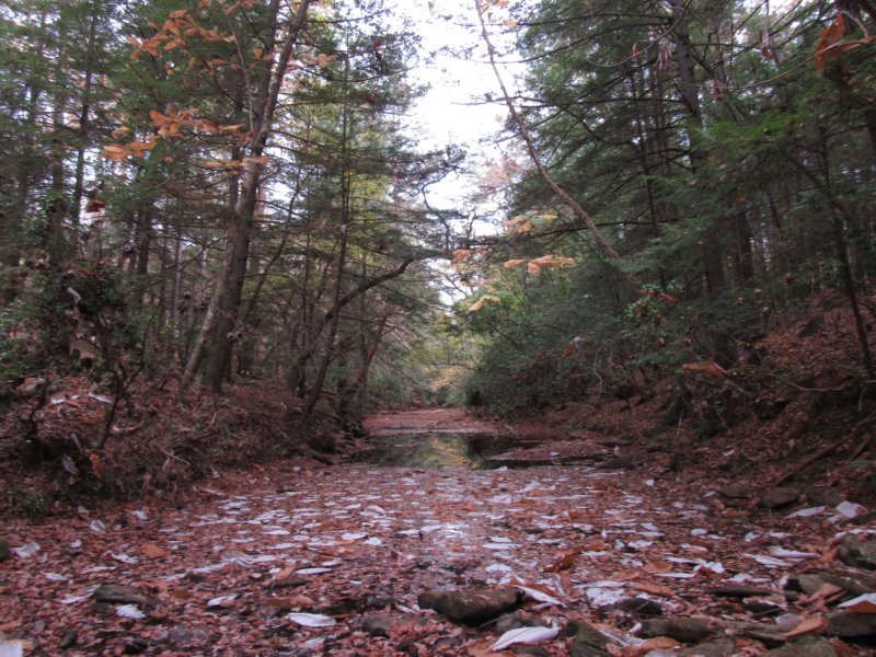
In what’s become an annual outing for me combined with Wild South’s Volunteer Appreciation gathering, I set out to explore north from the recreation area for a few miles to see what hidden treasures Owl Creek might hold. Friends and fellow volunteer wilderness rangers Brent and Betty joined me for this exploration, which originally had the ambitious goal of reaching the junction of Key Mill Branch. That didn’t come to pass, but we did manage to see the two most significant drainages prior to that junction. We didn’t expect to find waterfalls with the drought in full force, but as with every place I traverse in Bankhead or Sipsey, each one rewards with its own unique set of interesting features.
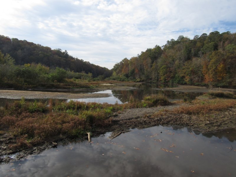
Before the hike, I arrived a little early to check out Brushy Lake, or what's left of it, from this drought. The sediment buildup has really taken a toll on the lake over the years, and the drought has made it possible to walk probably half the length of it straight down the middle, with waders, or maybe even knee high boots. Brushy Creek really has reclaimed it's course here, in a way. In another generation, the concept of this place as a lake will most likely be a misnomer. All that aside, it was nice to see some fish jumping, and also see the large fallen tree that once tangled my fishing lines so many times. I'd forgotten binoculars, again, so I can't speak as to what kind of birds were playing in the mud flats, and I couldn't hear them at any rate. After meeting up with the others at a campsite, we started our adventure with a stop beneath the cypress trees on the east side of Brushy Lake, where a stand of a particular orchid is sometimes in bloom even this late into the year, but we came up empty handed, as all had gone to seed. The colors of the forest, especially the cypress trees here, were as brilliant as I’d seen all fall, with the drought having robbed much of the good foliage further north already. Crossing the road, we did find late aster in bloom, and I spotted seed heads from cranefly orchid, the familiar winter leaves already popping up. As we walked the ground seemed liked it shifted a bit with each step, and I scrapped the leaves away with my foot to reveal almost pure white sand, something the big December flood of 2015 most certainly had a hand in supplying. In our pursuit, or my pursuit to see the confluence of Brushy and Owl creeks we stopped to gaze at a particularly large pine tree sporting a bat box that had seen better days. We also stopped to examine a reasonably active fire ring here. An obvious old road bed led down from the main road, though I'm not real sure how accessible this spot is by vehicle. The water here appeared quite deep, and dark, more of what one would
expect of the lake than the creek before it.
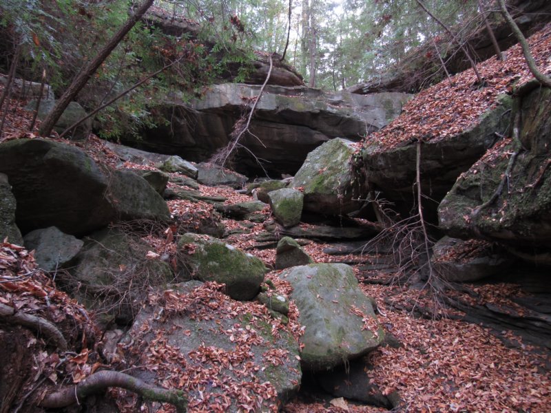
 Following upstream from the junction, we passed a few remaining cypress trees before breaking back into the typical scene of deciduous trees on the far side of the bend, and hemlock shadowing the cooler side. All along the banks of Owl Creek here mountain laurel grew, and the steep embankment imposed from the road above meant finding a way through the tangled mass instead of going around it. There were trash oddities here too, the liner from the inside of a washing machine being the most interesting find. We debated finding a way across the creek, as the forest was simply alive with color. The canopy of hemlock we walked under made for easy walking, though, with little understory, and we crossed the first little drainage, which was nothing more than a blip on the map. It was surprising to find the stream flowing, but we decided not to pursue it uphill as the road wasn't far away and the chances of finding anything of interest other than a spring would be slim. Making our way back to the creek, or as close as we could get venture with the mountain laurel blocking most of the view, we came across what were obviously man made structures of some kind. Given the parallel lines and rocks involved, my initial instinct was to label them graves, though Brent pointed out the oddity of placing them so close to a creek's edge. As we wandered the mature forest here, we came across one of the biggest hemlocks I've seen anywhere in Bankhead or Sipsey. The thick trunk reminded me of perhaps a few on the Randolph Trail, but seeing trees of this size always takes me back to the trees from the northern section of the Fiery Gizzard Trail. We crossed another little drainage that was dry, but the terrain became hilly, so I knew we weren't terribly far from the first little stream I wanted us to explore. As we crossed the dry stream, an old road bed swung around the hill. We followed it past a large white oak tree, again, one of the largest I've seen before. The old road followed high on a bank above the creek, which finally offered a view. The creek, just this little ways upstream was even now being reduced to stagnant pools of water from the drought. I made my way down what almost looked like a rock staircase to make sure I captured some photos of the actual creek this trip, and not just the forest! It wasn't long before we were able to find an easier, even drier way across, if we'd wanted. The hog sign was obvious, too, but we saw none in person. The next stream junction wasn't far, and I once I saw it I knew it was something worthy of exploring. There were many young hemlocks here, probably not more than 20-30 years old, and the creek seemed to meander endlessly. I was uncertain of how far we needed to go, as I wasn't certain we'd find any bluffs and the topo map is a hard judge sometimes regarding what one finds. We came upon a very small cascade with a small pool beneath and crystal clear water. In terms of water actually falling over something, this would be the most we'd see all day, though other spots gave promise of a return trip. A little bit of a rock stratiform wall crept out of the bank and rounded the small bend the area widened, and I spotted what looked like a dug hole for a moonshine still. Brent then found old tubing and sections of metal left behind, until we found a total of four large still holes in one small area. Quite a little operation here! A high bank and another little intermittent stream coming down provided a great source of water here. Nearby, we found an old road bed, which is something I see a lot of in Bankhead. We found fresh coyote scat, but with the thick leaves no prints around, something I enjoy photographing. The stream began to narrow a bit and I second guessed continuing up, as it seemed to be opening into more of a flat area.
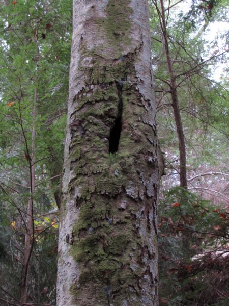
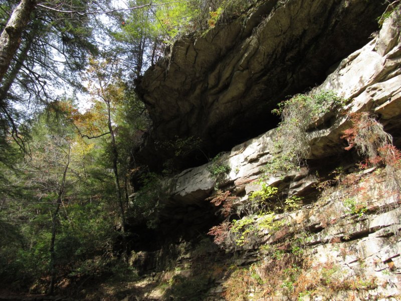
 Despite all of my wild goose chases, I'm still stubborn with wanting to continue, and so we did, finding another little cascade before running into a giant tangle of fallen trees and swamp like conditions. Ahead, though, I could see the land was shadowed, and the hemlocks tall. I told the others I'd hop ahead and see what was there, but they followed as we fought our way over a tall tangle of downed trees. I saw an old barrel down in a stagnant pool, and big boulders sat on the banks, which is a good sign at least in bankhead when you're waterfall hunting. I hopped down and immediately saw the bluff ahead and smiled. Brent pointed out a weird hole in a tree, but the odd scar around it gives it the distinct look of an owl; we'd found the owl tree of Owl Creek. The waterfall was completely dry, but sporting a large spring from below that made up part of it's plunge pool. After scaling the steep cascade area, slippery with dry leaves, we explored the small bluff area and found partridgeberry, liverworts, alum root, and some interesting tree roots clinging around the edge of the bluff. The waterfall had a very wide flat lip of an area that appeared to have a rock placed as a stepping stone where the narrow stream met it a few feet higher, and Brent was itching to get above and explore. We found a way through another terrible tangle of trees, and with a little bit of a scramble, were up on the bluff. His intuition was correct, and we found a second upper falls with almost equally impressive bluff shelter. In the spring this would be a pretty nice two tiered waterfall, and even better with the falls below. What was first dismissed as a rock cairyn was soon discovered to be a step here as well, to get above the wide lip of rock that made up this falls as well. Brent joked of a third falls and we laughed it off, but of course I had to check. He gave me a boost and I got above the second lip with a little rock climbing. I spotted a nice little hump of rock I new would be a small falls, and laughed. Then I spotted a pretty well preserved moonshine still and called to the others that they needed to see it. We found another dug hole nearby for a total of six stills on this one little drainage, and also a small shelter nearby the upper still, a great spot for mostly getting out of the elements if need be. I regret not poking a flashlight in some of the crevices as I've found some interesting things in these kind of shelters in the past. We knew the road wasn't far at this point, so we continued on up and it and found another little small bluff with the rocks beneath it arranged in an interesting way. I'm not sure if it was old retaining wall or a bit of a fire hearth that had fallen apart over the years. Uphill through the pines the hike became a bit tough, despite following an old road bed again. The understory here became a mess of devil's club and thorny bramble with wild blackberries mixed in for good measure.
 At the road, Betty decided to return to camp, while Brent and I decided to use the road and a few hours left of play time to our advantage and at least get down that next drainage to see what we could find. Passing the junction of Owl Creek road with Mt. Olive Road, we dropped off through the same bramble again, before stumbling across a very old but still quite pronounced road bed. This was an absolutely gorgeous walk through a deciduous forest in it's fall color prime, and we spotted a split tree, a headless horseman of sorts, the kind I call 'forest protectors', tall arms stretched skyward. As the road petered out in a bit of a mess of rock and land jumble the dry drainages to the right seemed to open in a bit of a small meadow like area, and despite the lack of water, a decent enough place to camp. Ahead, I could tell the land dropped off, and we found our first falls on this stream, a dry cascade that was easy enough to walk down, and sported what looked like another spot dug for a moonshine still, but not finding any other evidence of a still, I can't be certain. One small shelter showed obvious animal use, and we found more of the mounded areas that looked like graves before coming up another old road. The forest downstream did something I'm not sure I've seen before headed downhill into a watershed: after that initial thrush of hemlock trees, they all disappeared. The stream opened into a scene of brilliant yellow and gold, filling the either view all around. Some small boulders still crept up, but instead of exploring them we stayed to the road bed, high on a bank above the still dry stream below. We walked what seemed like a long ways through this scene, every bit of it delightful. When the road gave out, or turned around the hill, we found the second, more substantial waterfall here, a roughly 20ft two tiered falls with concentric wide round half moon levels. Downstream looked puzzling to me, and I called out to Brent that we'd found Owl Creek again. It seemed like it should have been further down this same drainage, but we dropped straight into a very picturesque bend, with a tall 50ft bluff on our right and alternating rocky streambed and stagnant pools of water. En route to explore that bluff we found muddy prints of raccoon and deer, and a variety of ferns still thriving here close to the water. The still pool past the bluff gave perfect recasts of the forest, and the somewhat littered top added an interesting element to it for me. A hollow tree provided the perfect frame for some photos, it's white bark stood stark against the leaves and water, rich in tannin. The high bluff here is somewhat reminiscent of Phantom Bluff on Hubbard Creek in the way that it stands against the creek, though nowhere as tall or grandiose. I snapped a photo of a butterfly that stopped just briefly in the mud here, and we opted to get back to the to the road versus exploring Owl Creek farther upstream where a chance of more bluffs remained. Along the way to the road, Brent showed me some spots I'd eyeballed but glossed over, including a tree whose root system wrapped a rock in such as a manner it was as if someone had taken a cross section of the entire root section itself and put on display. The photos would never do it justice. More short bluffs here would have provided additional waterfalls had this been a spring hike, and each seem to have a spring that the pigs have turned into wallows. It is hard to blame them this year, with the drought. Back to the road, a truck slowed down, and it was more friends, Robert and Barbara Howell, who offered us a ride back to the recreation area. The cool wind and scenic tour from the back of the pickup truck down that old gravel road made for a refreshing end and a great way to cool down. As we pulled in, I spotted Robin among the crowd, and rest of the afternoon was spent eating, and sharing some of the interesting things we found just on the other side of the road.
|