|
 Monte Sano Preserve, AL:
August 20, 2016
Oak Park Trail, Bankhead Trail, Flat Rock Trail, Buzzards Roost Trail
Distance: 5 miles
[View Photo Gallery]
I took almost six weeks “off” from hiking after the roadtrip to rest, let my knees recover, and really process all of the wonderful places I was able to explore. Hiking late summer in north Alabama is tough at times with the heat, and worse, the ticks. The Land Trust of North Alabama had been working on new trails for the Monte Sano Preserve for a while, and opened a new trailhead and two new trails near Oak Park a few months before I left for my roadtrip. Despite the threat of rain, and a late start, I set out to explore what I could. The trip would take a turn that I, wasn’t prepared for, and then reward me with sights I didn’t expect to see, taking me through an area that is now one of my favorite spots in the whole trail system.
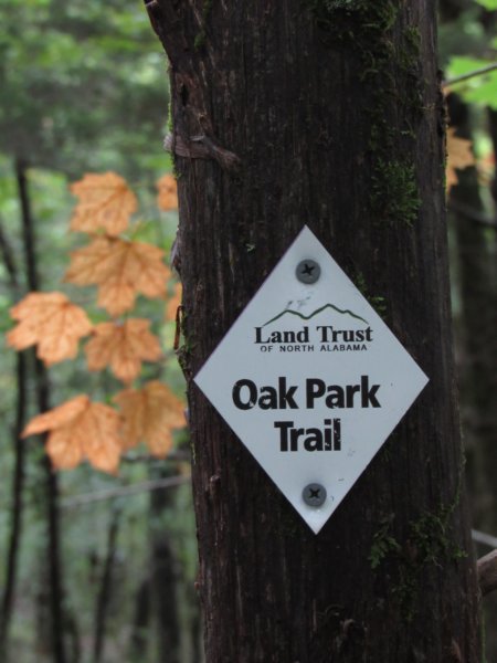
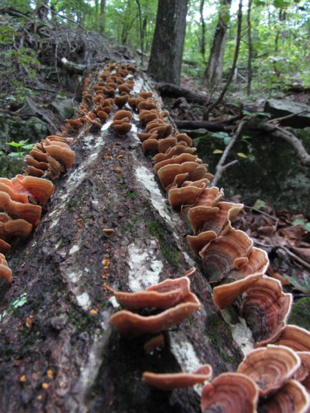
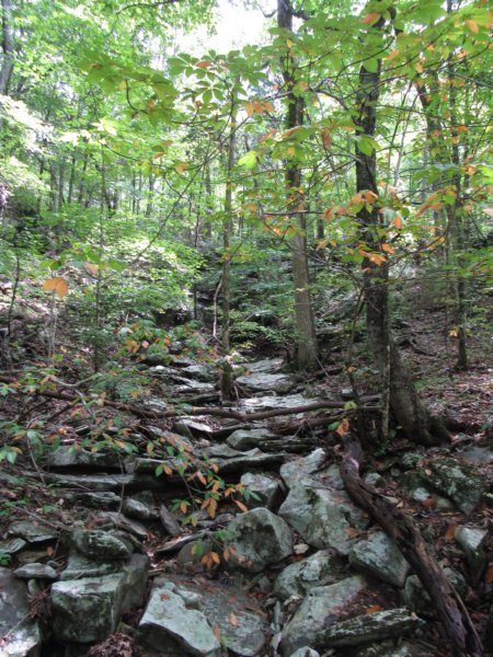
After figuring out where to park at Oak Park, I followed the lone sign pointing toward the trail down the paved path between the ball fields into an open field where the trailhead kiosk sign sat against the treeline in the distance. I stopped to photograph the map as I was having issues with the cell phone loading the map application. Buzzard's Roost Trail, a spur loop off the main trail, particularly interested me as it notated a spring along Dallas Branch. It seemed the best potential to see some kind of water flowing, though that's difficult to find on Monte Sano this time of year. Right as I stepped on the trail I noticed a kid's bike ditched in the bushes on the side, and a kid wandering up the trail ahead of me. The trail was wide and clear, with a few blooms of morning glory and indian tobacco popping up as the canopy thickened. Heading uphill, the trail split off into a number of social trails that led downhill to the very visible subdivision [probably where the bike owner was headed], and uphill toward parts unknown. Crossing a small drainage, the trail leveled out on top of a long muddy berm. Years of erosion has forced a new drain of sorts to form alongside it. I can only surmise that the residents below had it installed to divert some of the flash flood style flows of the minor drainages above. As the trail left the berm and turned uphill again, someone had lined the trail with lime yellow fake flowers. Also through here were piles of stones not quite organized like cairns, and I never quite figured out what they were used for. Uphill again through a mature deciduous forest, the path seemed to continue to parallel the mountain before turning downhill crossing another dry drain. Amazingly, the dirt berm was still visible downhill, though the houses were becoming more distant finally. Continuing the uphill grind, I spotted an old road bed that seemed to be where the spur for the Buzzard Root Trail was, but there was no signage indicating it as such. I skipped that in favor of doing the loop downhill at the end of the hike. Passing a more significant drainage, the mountain slopes became much more angular, with lots of rocks and small boulders, and a long tall dry cascade reached up through the forest until it was lost in the undergrowth. The previous spur turned out to be yet another social trail, as the real turnoff was marked with a small cairn just ahead. I walked alongside another dry stream for a while, but stopped to explore up the next stream crossing as I spotted a small bluff of sorts. Had there been water, a 10-12' high set of falls would have flowed through the tall layered narrow shoot before a short drop to the rocky stream channel. It would have been nice to have seen with water flowing over it, but the number of resurrection ferns, a personal favorite, and white teacups still in flower, made up a bit for that absence. Climbing farther up the mountain, the rocks and boulders became more numerous, and I passed the upper spur to the Buzzard Roost loop, with a traffic circle of sorts built around what almost looked like a small garden area with a nice boulder to sit on and eat a snack. The steepest segment yet was ahead, but short, at least, as the Oak Trail met up with the Bankhead Trail, a former portion of the Flat Rock Trail that circumvents the mountain. Above the bluff at the junction is Bankhead Parkway, but the Flat Rock Trail here itself resembled an old road bed of sorts. With the main trail heading left, I ventured right to see where the trail crosses the road to meet up with the main trail system of the land trust property and the Dummy Line Trail north of the primary preserve trailhead. Wide and uneven, it was not terribly obvious here that this was the actual trail, as markers weren't very visible along this stretch. At an obvious split of road versus footpath, though, I chose the footpath and soon the markers became noticeable again. Along the way, I stopped to photograph spotted wintergreen, and some cool bronze orange fungus as the trail turned into an undefined scramble up loose rocks beside another rock filled drain, most likely the head of one of the dry stream with the falls from earlier in the hike. It was obvious not many people have ventured this way, as I couldn't find so much as a game trail at times. Ending at a culvert under the parkway, I briefly ventured across to see exactly where it went, but with the thick underbrush didn't spot an obvious route.
 Back downhill, I took a little time to explore a few of the small rock outcroppings, mostly looking for springs, but came up empty. Passing the junction from earlier, the trail again split, with an old road heading decisively downhill and a narrow footpath staying more with the lay of the land. With the rockier landscape, some tall cedars mixed in, and the trail suffered from a number of trail blockages. I passed another dry waterfall, and the woods opened a bit, breaking into a sea of a invasive euonymus groundcover. A tall oak, another in a series of trees I call the 'forest protectors', appeared as if with arms raised above many of the canopies, it's original trunk sheared off and two “arms” reaching for the sky. As the trail moved through a bit of a younger forest, I stopped to pick up a few persimmons, though they unfortunately were split open and inedible. Along this section, I noticed a different type of marker for the trail, bright green and made of tall flexible plastic. It's the only trail I've seen with these style markers. As the rain began to fall just a bit, I stopped to photograph deer tracks, longer than usual as they slid through the sticky slick clay mud. I was surprised as the canopy cleared not far ahead, and an old road cut through. I'm not sure where it led downhill, but I suspect uphill it leads to the one random gravel road that's always gated along the Bankhead Parkway. The trail on the other side immediately started with a small bridge over an intermittent drain. It was here that my camera batteries promptly died, adding a bit to my frustration of setting out without proper rain gear. It wouldn't be the first time I've completed or even photographed an entire adventure with the much grainier cell phone camera, but I'd rather have poor quality photos versus no photos at all.
 I stopped to photograph a cool old cedar tree that had split and pushed up a long flat rock, a great little shelter for something small, but not for me. The rain really started to come down, and with no rain jacket, I found a clump of trees that blocked most of the wind driven portion of the rain until the heavy shower passed. I checked the radar and saw a bit of a broken squall line had formed, but there was no turning back for me at this point. I would get caught in it either way. I briefly ventured downhill on what looked like the correct path at a junction, but I think now that trail is the continuation of the Flat Rock Trail. Back on the Bankhead Trail, I followed along uphill, stopping to study an animal's den that looked freshly dug, but never was able to find decent tracks to photograph for an ID. As the forest matured again, a large oddly placed jumble of rocks sat just off trail, which seemed to have cool air flowing from it, though the top here either collapsed or someone filled this entrance with boulders, as there was no way to get in. Behind the rock pile was a possible old quarry, with social trails leading out through it. Uphill the trail became rockier, with an occasional small sinkhole here and there. Beyond the underbrush to my right the fence for the water tower was visible, but time wasn't on my side to keep exploring off trail, though I love photographing water towers. The path split again here, with one going sharply uphill toward the water tower and probably to the road, and the other to the left, which I kept with. Both were flagged, but the left path seemed extremely fresh, and I'd later learn that this was a trail extension that really hadn't even been announced at the time. The earlier rain and returning sun produced billows of fog through here that wafted and waned. I came across a square concrete box, large enough that would work as a rain shelter in a pinch, though not ideal. I also spotted a golf ball buried in the mud, and a small collection of old glass bottles someone had set aside. It always amuses me finding golf balls in the woods, as I wonder how they got there in the first place. After finishing the path out to the road, which paralleled extremely close in sections, I found that the new trail terminated where everyone parks at the hairpin that leads the back way to Monte Sano State Park along the closed portion of the Bankhead Parkway. I thought about venturing down to see the waterfall just downhill from the parking area, but thought better of it seeing the dark skies in the distance and figuring I really only had about half an hour before the storms were upon me.
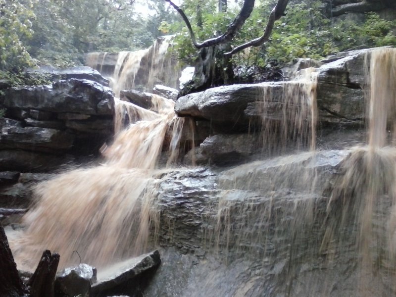
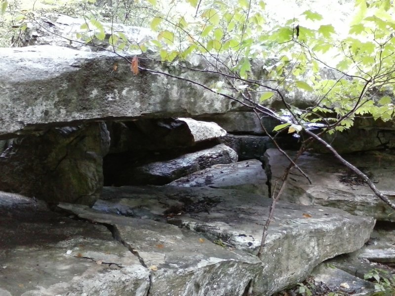 I had no option other than to make haste back down the trail and try to find a big enough tree to hunch under to ride it out. I ended up doing better than a tree, spotting a small overhang on the bluff about a mile back down the trail, and hunkered beneath it as the storm cut loose. I'm thankful I had my hat, which helped deflect some of the seeps that formed, though after about 30 minutes of torrential rain the limestone began to seep everywhere, soaking my back. Despite middle of summer, the cold water actually had me chilled a bit, so I set hiking again to warm up, all the while keeping an eye for another shelter if need be. I made my way back to the junction with the Oak Park trail, but upon reaching the Buzzard Point Trail, I decided at this point I was wet enough it didn't really matter if it rained again. I was here, and I was going to see this. Slipping a bit through the mud, I passed one small intermittent stream before hearing an odd roar in distance. A bit of disbelief came over me as I found Dallas Branch, and not a spring, but a 5ft wide channel of water launching itself over the 20ft high stair-stepped falls. I ventured below to photograph it, the milky orange water really looking a bit strange against the white rocks. I could see a side channel downstream that fed in, and I'm guessing that's where the spring is located. Back atop Dallas Branch Falls, I found the stream wasn't very deep at least, and trudged through to the other side pretty easily. In an attempt to find a way to photograph the falls from the other side, I found the largest natural bridge I've ever seen at Monte Sano. While only about 3ft high, it spanned a good 15ft and would have been an absolutely fantastic spot to have ridden out that storm. With a dry spot to sit, I took the opportunity to rest and eat a snack before venturing farther off trail for more photos of the falls and some of the interesting rock formations. Knowing the trail followed the water for a bit I wasn't worried about losing it, and it eventually reappeared as a bit of a steep slippery descent down to the water's edge. I followed the stream back up almost all the way to the falls photographing the pools filled along the way. Downstream, I chased another set of cascades uphill off trail until it was obvious where the spring was, and the terrain became too much to continue. The trail forded the creek once below, and then back again before I lost sight of where exactly it was supposed to go. I crossed, wandering through some lowland areas before giving up and crossing again. I eventually found the berm again I'd seen when I first started the hike, along with a box culvert funneling the water away. Kind of hidden in the brush to the side was a social trail that I picked up, which led down an old road bed past spent jerusalem artichokes and rose pink still in bloom. I'd yet to see any signs labeling this a trail either, until I caught a path venturing at a right angle away from the road, and on a far tree, a trail marker. I stopped for a minute to see where the roaring little creek led over another culvert here, though the underbrush didn't allow for much viewing. The trail from the waterfall to here was the quietest section of this part of the preserve. The views opened a bit as the woods became more mature deciduous trees again, crossing a surprisingly dry stream bed before making the join with the Oak Park trail back slightly uphill. On my way back downhill, I stopped to check on the first substantial potential waterfall of the day, only to find it dry as well. It's an area that certainly warrants exploring again when the conditions for good flow are right. But with the skies darkening again and more threat of rain, I quickly trekked the remainder of the trail and made my way home.
|